Monday, March 25, 2013

Terrapin Mountain 50k

You win some and you lose some, and sometimes you take a wrong turn less than a mile from the end go an extra 1.5 miles out figure out this can't be right and turn around to add an extra 3 and really lose some.

I had never run Terrapin before, but always wanted to. This year, I was able to. I drove down on Friday afternoon and picked up my friend, Matt from JMU on the way. We were planning on going by Clark Zealand's (race director) running store, The Aid Station, then going to the start line where they had packet pickup. The Aid Station was very impressive. It's all the trail shoes and stuff for ultra and trail running you see on-line but no one carries in stores because there's not a "big enough demand for it." Well, the Aid Station is where it all is.

Matt and I arrived at the starting line around 6 o'clock to the smell of fresh pizza from a Domino's truck. That truck rules and if I ever win the lottery, I'm buying one complete with a staff to just live in the back and bake me hot fresh pizza at all hours of the day. Anyway, we spent the evening visiting with friends, eating pizza, and enjoying the cool mountain air. Oh, and Matt didn't bring a jacket or coat to camp in March. Lucky for him, I brought an extra couple layers. He probably would've died of exposure if I hadn't. I probably saved his life, no big deal.

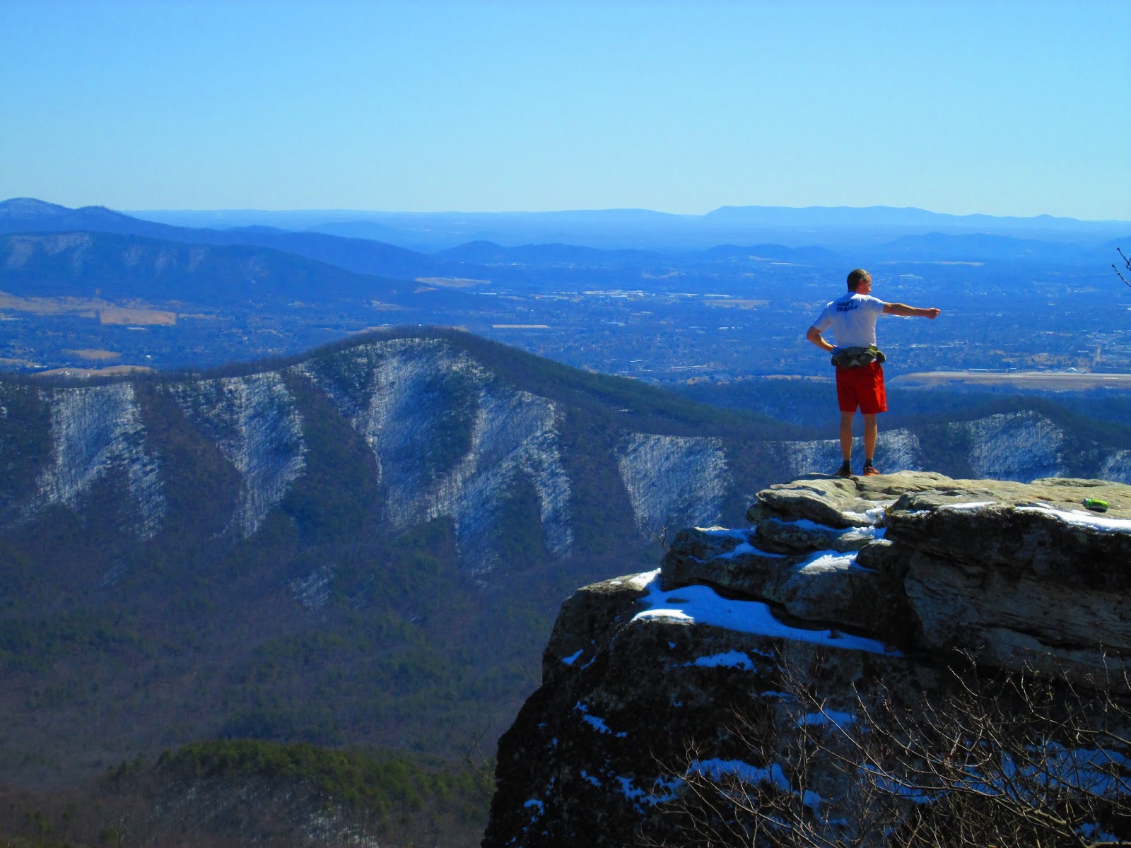
Terrapin Mt evening before race
 The temperature probably only dipped down to the low 20s that night, I doubt much lower but it was chilly. We awoke the next morning to Clark's voice over the loud-speaker. "Good morning everyone, please check in....we have coffee for you." The man was luring us all out of our toasty sleeping bags with the promise of caffeine and warmth. The problem was, there was a bridge of chilly air between the starting and ending stages of warmth.

Fast forward, to the race: we started with the sound of a gong. A real one, made by the cymbal company Zildjian. I didn't stick around to ask them who's gong is was. We were off. The group off the front was sizable containing both the 50k race and the 1/2 marathon race. Down the road we made a left, then we made a SHARP LEFT and a SHARP RIGHT. These directions would be important later...but then again, opening my eyes would've been more helpful.

I had a goal to finish under 4:30 just based on what people I knew had done. After a mile we started to climb a little more gradually people spaced out a bit and I ran in a group with Jordan Whitlock, Neal Gorman, and a guy named Ryan Welts who was from New Hampshire. Frank, Sam, and a guy everyone just referred to as "the 2:30 marathoner" took the first climb to Camping Gap #1 a little more ambitiously than we did. The four of us traded spots a couple times up the first almost 2,000' climb but were all within about 2 minutes of each going through the top of the climb. Immediately following the aid station at the top, we descended the other side of the mountain. Neal blew us away and seemed to be making a break for the leaders as expected. Jordan, Ryan and I ran pretty conservatively down the other side blowing through the second aid station.

Toward the bottom, I pressed on and went through the third aid station without stopping. I saw Neal up ahead during the next climb and figured I was staying about a minute behind him consistently. I caught him after we entered the steeper single track on our way back to Camping Gap #2 and Ryan caught up with me again. Neal said something about not feeling great, which would explain why we caught him. Ryan and I ran all the way back through the fourth aid station and up to Camping Gap #2 together. We were running pretty conservatively I think but still not going too slowly either. On some of the switchbacks we could look behind us to see if there was anyone coming for us, and we didn't see anyone. When we reached the aid station at the top, Horton yelled to us that we were 4 minutes behind Sam and Frank who were running together. Ryan and I started the White Oak Ridge loop together but I lost him on the first part.

That loop was really my only down spot of the race. The grassy double track made it look less steep than it was and became discouraging because it was difficult to run. I knew I'd feel guilty walking it, so I just kept running and tried to keep my heart rate under control.

After close to 3,400 ft of somewhat continuous climbing, the summit is rather uneventful since it's all wooded but soon enough, I started running down. I let gravity do the work and I just focused on staying upright. Rolling back into Camping Gap #3 for the last time, Horton yelled that Frank and Sam were still 3 or 4 minutes ahead. I couldn't believe I hadn't made up any significant time after the downhill I'd just come off. From Camping Gap #3, it's largely downhill to the finish with a few short but steep climbs. The first being the steepest up Terrapin Mountain. I knew the chances of catching them on an uphill would be highly unlikely and we still had 8 or 9 miles left, so I took the climb hard but not too hard.

As soon as I punched my bib number at the top of the climb proving I was there, I charged down the mountain. The trail gets very technical in a few spots with loose rocks, loose dirt, little to no footing and the pair of rocks that make up "Fat Man's Misery." Fat Man's really is rough. It's a steep downhill alley of slanted rocks that I initially went to jump down and quickly realized that was a bad idea because I slid the whole way down it just pushing off one wall to keep my face from being scraped off. I continued to careen down the mountain now passing 1/2 marathoners but keeping an eye out for Sam and Frank.

The last aid station is at the end of a little 1/8 mile spur as I was going down to the spur, I saw the two of them coming up the trail. I looked at my watch and noted the time so I could see how long it took me to get to that same spot. Upon reaching the aid station, I snagged one gel and yelled out my number. I didn't even stop running. I reached the spot where I crossed them with a gap of 2 minutes. I was closing.

The last section I had heard was all very run-able but was also 5.5 miles long. If I pushed really hard too early they might out surge me at the very end so I made sure to never be comfortable but not go too hard. It was very exciting! I felt like I was hunting. The trail meanders in and out of the ridges of the mountain and every time I came around a corner I looked for them. I stayed calm...until I saw them. We were still too high on the mountain to give it all I had. I knew we still must have had about 2.5-3 miles left. I increased a little bit but not too much. They had a 1:15 lead on me. I saw them on the next ridge just disappear beyond sight as I came into the ridge. 1:10 lead.

Finally, came the creek crossing. As I descended to the creek, I saw one of their heads disappear around the corner. This is normally a somewhat calmer crossing from what I've heard, but this year it was flowing pretty heavily, I jumped in and crossed not even thinking of any way to keep my feet dry. I got to the same point where I saw them within 1 minute.

I turned down the wide trail and stood on the gas pedal. I knew it was just a rough gravel trail, that gave way to a smooth gravel road, which turned right onto a paved road, and then I'd be home. I saw the "1 mile to go" sign at 4 hours and 10 minutes thought, sweet, I'll probably finish by 4:16 and turned off my brain. I told myself not to think and just run as hard as I could...but I didn't realize I actually stopped thinking. I reached the road and took the right but didn't see them. I knew they had to be close, I surged harder and harder but still couldn't see them. 4:15 came and went...4:16....4:17...4:20....? Someone had to be messing with us with that one mile sign. At 4:25 I decided I had made a wrong turn. I ran back to the last intersection with streamers and sure enough, I was supposed to go LEFT and THEN RIGHT. I didn't know how many people had passed me but I went the right way and found the finish line. I crossed in 4:35 in 8th place.

Things I learned from this race:
-Run hard but not so hard you can't see a thousand streamers and chalk arrows in front of your face.
-It's probably best to just not tell Horton you got lost - even if you admit you're an idiot for it. He will make relentless fun of you.
-Don't turn your brain off.
-I actually can turn my brain off....which I think is more scary than anything.


Matt enjoying some veggie burgers after his 5:10, first mountain 50k finish

Jordan Whitlock went on to drive far away to his Spartan Race (obstacles) and win it on Sunday...pretty sick. 

Matt after his first mountain 50k

The mountain. 

Wednesday, March 13, 2013

Catawba


This was probably the weirdest 35 miles I've ever run. Short version goes like this: Cold, friends,stomach hurt, stomach felt better, snow drift knee to thigh high, rocks, no rocks, more snow, snowman, snowballs, cliffs, hot, no shirt, strong sun, more snow, McAfee's Knob, sloppy mud, everyone and their mom, unseasonable snake, hanging at aid station, run, walk, run, slippery snow, field, finish in 1st (but it wasn't a race). Drive.

The course was hard, and actually that's a bit of an understatement, but it was made harder by the strange snow conditions and the warm temps...and even those are two things that don't normally go together.

Most people use the run as an excuse to get to the mountains and see trails they don't normally run on, at least that's the way I was treating it. That being said, it is an awesome event that hits some pretty defining parts of the Virginia portion of the Appalachian Trail.

I drove down on Friday night after traffic had subsided so I got down to the area around midnight. I slept in my car in the parking lot of the hotel where most everyone was staying mainly because I was too cheap to get myself a hotel room. I woke up early after a few hours of shut eye and went to the B and B where the start and finish is located. The people that own it are incredibly kind and have let Keith put this event on for years.

The start area was full of people gathering last minute supplies and we were all glad that daylight savings time was Sunday instead of Saturday so no one had to run with a headlamp to start. Gary was running around the parking area semi-forcing people to eat Krispy Kreme doughnuts courtesy of Quatro before they started running. In a brief lapse of judgement I succumbed to the temptation of a greasy/slimy doughnut and by the time I realized my mistake, the doughnut was already down the old gullet.

A few words were spoken, and we were off. This year the circuit was run in the opposite (clockwise) direction so we'd be heading up to Dragon's Tooth first. A couple miles into the run I was running with Sean Andrish, Drew Krueger, and Jeremy Ramsey. We ran most of the climb but then the doughnut was wreaking some havoc. I made a brief trip to the woods quite a ways off trail and was fine after but was now several minutes behind the other 3 guys. I ran by myself up to the top of Dragon's Tooth enjoying watching the sun rise higher in the sky and finding my way through the mess that is the rock scramble before reaching the intersection at the top.

Dragons Tooth
I crossed paths with Sean, Drew and Jeremy while they were on their way back from the Tooth. I saw the towering rocks, snapped a couple pics and turned around. I caught up with them just before the intersection and ran the rest of the way down to the first aid station with them. As we reached the aid station, nature called and luckily there was a bathroom in the parking lot the aid station was in. When I came out, they were already gone. I wasn't too worried about it as I had a map in my pack, but it did mean that I'd have to run by myself on trails I hadn't been on before and were not marked.

The next section is notorious for its PUDs after the initial climb. The ridge is just piles of Pointless Ups and Downs. It's like running on an amplified boring part of a roller coaster. They are rarely dangerously steep, but they still drive you nuts. People who had done this event several times said there were 36 of them over 9 miles or so. Adding to the slight annoyance was a new obstacle: deep, windblown snow drifts. Some were deep enough to stop you in your tracks making progress very slow and exhausting. THOUGH, subtracting greatly from the misery that these things caused were the views. They were incredible. The temperature was warming drastically and having no leaves on the trees meant you could see on either side of the ridge. Beautiful.

After about an hour or so I caught up to the group just as Jeremy was emptying sticks from his shoe and stating he had some stomach pains. We all figured that he'd catch back up, but we didn't see him for the rest of the day. Drew, Sean and I rolled through the hills and snow and finally made it to the intersection that took us down to the second aid station at mile 17 ish. The three of us hung out there eating and drinking for far longer than I think any of us would in a race. Brian Schmit joined us for the next section as he planned to run with whoever was in front so he could get to his car (the third aid station) with whoever got there first. That next climb was a good little kick in the teeth. Very steep. Somewhere along this climb we lost Sean and Drew and came upon a couple of people who didn't really know what this trail had in store for them. If I had to guess, they didn't get all the way to the cliffs at the top.

HI RUN
Brian and Sean Tinker Cliffs
 Brian and I decided to make a snowman on our way up. We wanted it to say, "Hey Sean" or "Hey Drew," but both had too many letters in their name to spell out in sticks so we settled for, "HI, Run." On the switchbacks toward the end, we could see Sean way down below and slowed down as we got close to Tinker Cliffs so we could run with him.

 
Tinker Cliffs
He joined us in fighting the still snowy but now, warm conditions. We descended the saddle and started the long climb up to McAfee's Knob, the very distinctive rock formation that also appears on the AT Virginia license plates. After a long long time climbing and sliding around because of the slushy snow, Brian and I arrived at the Knob but had lost Sean in the mix. There are actually two vistas. We went to the first one but missed the turn off for the second (and more popular) one. The view was still amazing.

From McAfee's, we sloshed our way down the 4 miles or so to the parking lot splashing in the mud puddles, slipping on the snow and passing huge groups of day-hikers headed up to the Knob. Everyone and their mom was out on the trail. I figured I'd wait for Sean when we reached the parking lot because I wanted to run with someone and Drew showed up next. After learning that Drew didn't pass Sean we figured somewhere along the way, Sean must have taken a wrong turn. I must have spent 20-25 minutes in that aid station but Drew and I finally left and decided to take it easy for the last section. The problem was, I kind of just wanted to be done by that point. The moving had been so slow because of the snow and slush and my feet were soaked, so I ran ahead. The last section is very pretty ridge running but again was very sloppy and hard to get into any kind of rhythm.
Not sure why he was pointing in almost every pic I took...
McAfee's Knob
Finally I came off the mountain, dashed across the field and up the road. I wrote down my finishing time which was 2:20 pm. Yep. That's 7:50 for 35 miles. That's almost 13:30 per mile! It wasn't until I did the math that I realized how slow I was going. A few minutes later, Drew came in and then Joe Dudak, then a couple of Virginia Tech guys. The snow was really an equalizer. Eh, at least it was fun.

Wednesday, March 6, 2013

Buckhollow, Mary's Rock, and the past

A couple of weekends ago I went for a run around the Buckhollow loop with the addition of adding Mary's Rock with my friend, Matt. The day itself was unseasonably warm as within a mile up the first climb both of us decided it was warm enough to go shirtless. It was the first time in 2013 and it was still February! The loop itself is pretty much 3 miles up and then 3 miles down, and add in an extra mile to each direction if you do Mary's Rock as well. For the first loop we opted to go all the way up. As we started the trail up to the top, I realized that I hadn't been on that trail since middle school.

For middle school and high school, I wasn't very athletic, and unless it involved being on a bike or playing baseball, I wasn't too keen on being active in general. During elementary and middle school, my parents would drag us out to Mary's Rock listening to John Denver or Bob Seger the entire way. The Bob Seger will haunt me forever (even though, somehow the John Denver has grown on me a little bit, but don't tell my parents). I didn't appreciate the woods, and hiking up hill for a mile was work, and my legs always hurt. I hated the way up.

But my parents did know how to entice their four kids to climb a mountain - food. My dad would pack up a big backpack with a Coleman stove, the gas for it, eggs, bacon, rolls, condiments, apple juice and orange juice mixed together (if you haven't tried it, you must), water, plates, napkins, wet wipes and utensils. He would lug all of this up there and then cook for us on the overlook. It was great eating, but inevitably the eggs would burn, the bacon may or may not be on fire right before you eat it, and of course someone would end up in tears because they were sticky from the juice. But being up there and scrambling around the rocks and then eating like that was definitely worth the struggle to get up there. The way down was great, we'd all pretend we were running with deer or escaping the bad guys or something along those lines. Running down felt effortless, jumping from rock to root, back to rock, was a feeling I don't often forget. Of course we couldn't run the whole way down because someone would need a piggy back ride.

While Matt and I were out there, I was able to remember every step of that mile. How, soon after the initial steep part leaving the parking lot it smooths out for a few yards. And how you pass an old chimney and then it gets technical. Also, after you reach the saddle section, you make a right on the AT and then a left soon after that and then it gets really rocky. It was only a mile, though, it felt a lot longer when we used to do it. It was just as rocky as I remember and the top was just as awe-inspiring.

Running up, the cloud cover was thick. I was worried we wouldn't be able to see anything at the top. Sure enough, we walked across the 10 ft of sandy flat portion at the top and continued onto the uneven rocks looking at nothing. I couldn't have been more disappointed. It had been years since I'd been up there and I wanted it to look the same and all it looked like was a sea of white/gray emptiness. I had brought my camera but didn't even bother to take it out. I explained to Matt what we were supposed to be seeing: The Massanuttens, Luray, Rt 211 and Skyline Drive. I told him that the cars on it are supposed to look like tiny Lego vehicles. Part of me wondered how much of what I remembered was actually part of it, and maybe the sights weren't as grand as I remembered.    

 Matt just as the clouds were parting

 Rt 211, there is a car in the picture

Some random dude behind me losing his balance...

Just when we were going to start going back down to complete the loop, I saw a faint mountain in the distance. The clouds were dissipating right in front of us! Within a minute we could see the tops of the mountains next to us and a few across. Before too long we could see down the cliffs. Everything was just as I remembered.

Last week was MMT training run #3, the last 40 miles of the course. It was surprisingly cold and snowy, even though the couple days before it had been pretty warm. The run itself was largely uneventful, I came, I ran and I left. The run itself just sort of seemed like a blur. I didn't think much, which could be a good thing or a bad thing. I didn't feel very invested in it, I just wanted to see that part of the course again without markings. Overall though, it was a good day to run in the mountains.